A road,
surveyed from a vehicle
A mobile mapping run along a country road: laser scanner, spherical camera and 174 stations with photos. The job is an inventory: the overhead power line with its supports, the road signs, the edges of the carriageway. The program finds them along the run; the operator checks them with the photo of the same place beside the cloud.
- 174stations with photos
- 45supports, 47 spans
- 113sign candidates
- 852 mof carriageway measured
The road as the vehicle saw it
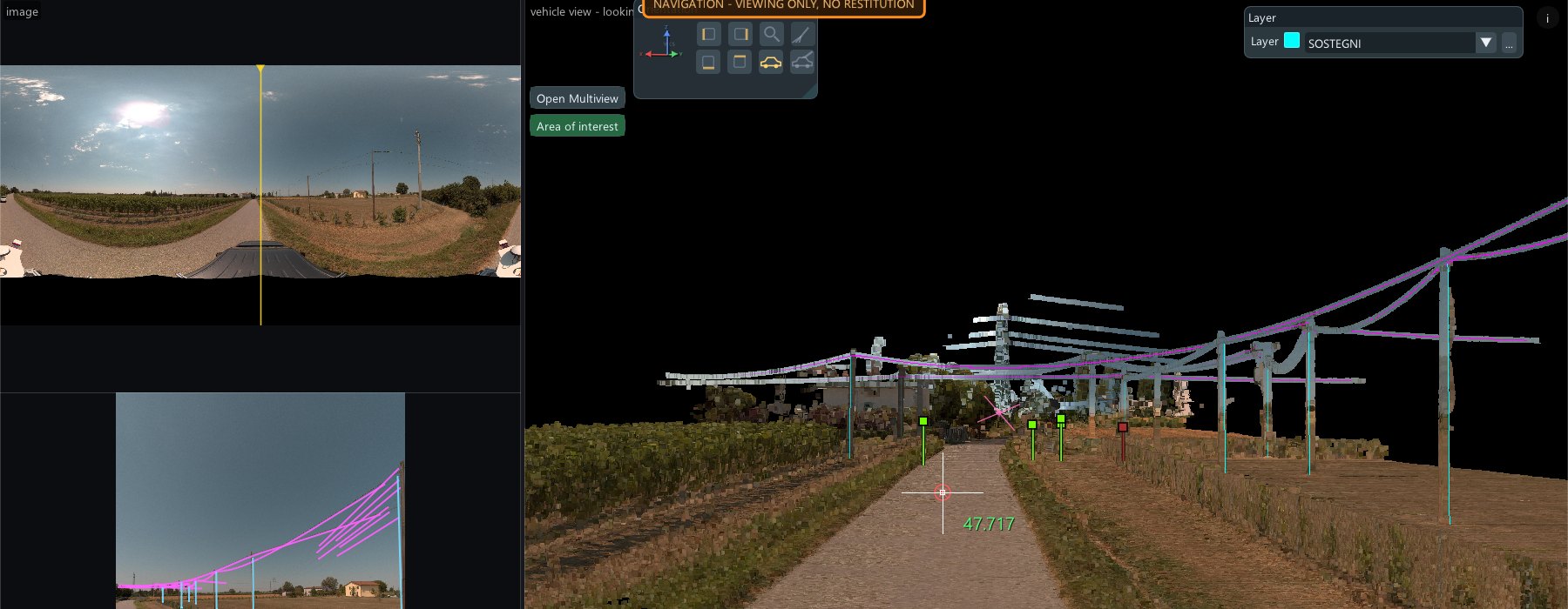
The vehicle view puts you where the vehicle stood: the photos of that station on the left, the cloud on the right, from the same point of view. The wires found in the cloud are drawn over the photo too, so every line can be compared with the real thing.
The power line, support by support
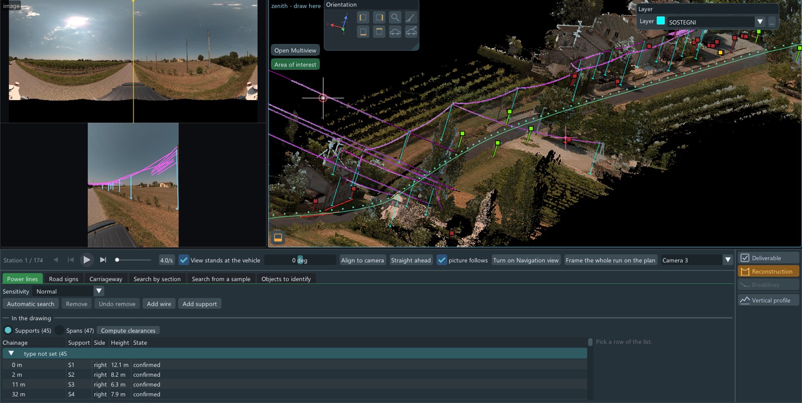
An automatic search finds the supports and the wires between them: 45 supports and 47 spans, each with its chainage along the road, its side and its height. Missing pieces can be added by hand: a wire, a support. Clearances are computed from the spans.
Road signs, with a second opinion
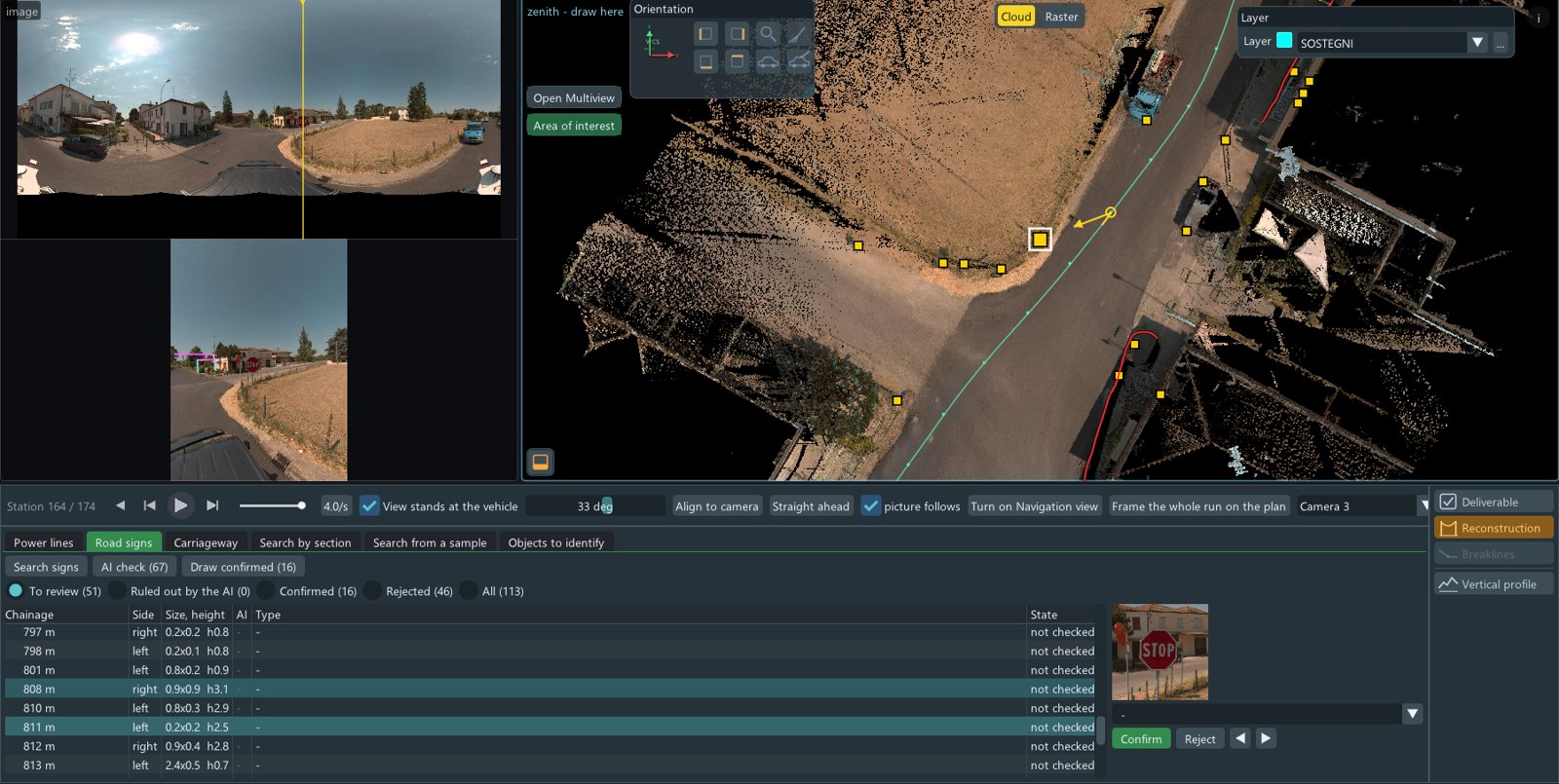
The search finds 113 candidates along the run, with size and height. An AI check looks at the photo of each one; the operator confirms or rejects, with the picture of the sign in front of them. In this run, 16 confirmed and 46 rejected so far, the rest still to review.
The carriageway, measured
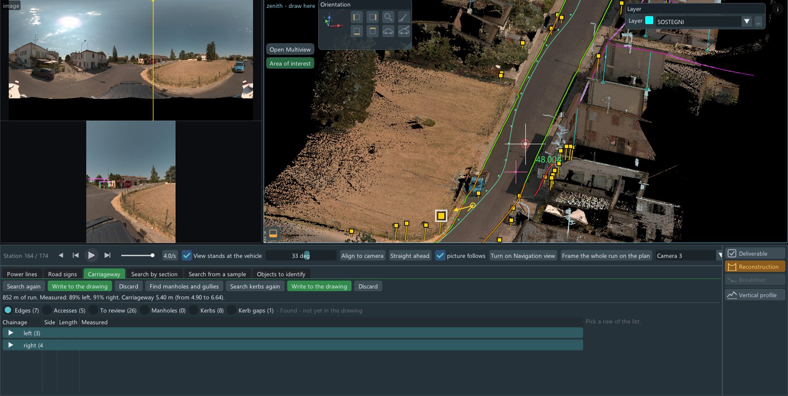
Along 852 m of run, the edges are found on 89% of the left side and 91% of the right. The carriageway is 5.40 m wide, from 4.90 to 6.64. Accesses, kerbs and the gaps between them are listed; what is found is not yet in the drawing until it is written.
One inventory, ready to deliver
Supports, spans, signs, edges: confirmed objects go into the inventory archive and the drawing, with the tables of the delivery. The same run can be opened again and the same checks repeated.